|
|
| |||||||||||||||||||||||||||||||||
|
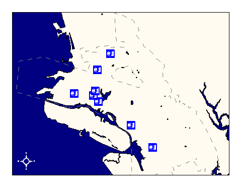
City of Oakland data set: BART station locations |
|
 |
Who maintains the data for this layer: OCIS GIS Consulting Team Data Maintainer Phone: (510) 238-6855 Who converted the data into a GIS format: Kyle Draganov, Jonathan Lowe GIS Technician Phone: unlisted Size of GIS layer (KB): 88 Size of export file (KB): 12 Where is the layer stored (on the k-drive): k:\gisdata\trans\bart_stn.e00 This GIS layer was last updated on: 10/25/96 This metadata was last updated on: 3/20/97 This layer's FGDC category description is: Transportation |
|
Data Set Description: This layer contains the location of BART stations within Oakland City limits. Since stations have multiple exits, the points approximate the centroid of each station. Non-standard Attributes in table:
Data Source History: The station locations were inferred from locations visible on the digital ortho photos and as marked on a AAA paper street map. The street pattern was used as a reference point between the AAA map and the digitized bart_stn coverage. Quality Check: The coordinate accuracy of the station points is not ground-controlled and should be used for general reference purposes only. Users at OPB discovered that West Oakland BART station was missing from the dataset in late 1996. Kyle Draganov, Earthwise Consulting, added the West Oakland station to the layer in early 1997. Security restrictions: No security restrictions Update Frequency: No scheduled updates. Update process:
Update process is not yet defined. |