|
|
| |||||||||||||||||||||||||||||||||
|
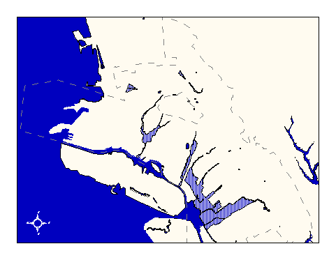
City of Oakland data set: Flood plains |
|
 |
Who maintains the data for this layer: Joan Curtis, OPB Data Maintainer Phone: (510) 238-4777 Who converted the data into a GIS format: Jake Schweitzer GIS Technician Phone: unlisted Size of GIS layer (KB): 226 Size of export file (KB): 409 Where is the layer stored (on the k-drive): k:\gisdata\hydro\flood.e00 This GIS layer was last updated on: 2/20/97 This metadata was last updated on: 3/20/97 This layer's FGDC category description is: Hydrography |
|
Data Set Description: This layer delineates flood plains along Oakland's waterways, showing the probable extent of flooding for given time intervals. The layer is annotated, showing 100 year (A) and 500 year (B) flood plain boundaries. Non-standard Attributes in table:
Data Source History: Joan Curtis (Office of Planning and Building) supplied Jake Schweitzer, In Situ Mapping, with paper Flood Insurance maps of the City of Oakland. Jake scanned or manually captured the boundaries of the flood plains on these maps and assigned them attributes (A or B) as labeled on the source maps. Quality Check: Joan Curtis reports that the original maps were surveyed at too small a scale to be useful beyond very general reference purposes. Security restrictions: No security restrictions. Update Frequency: No updates scheduled. Update process:
Update process is not yet defined |