|
|
| |||||||||||||||||||||||||||||||||
|
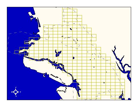
City of Oakland data set: Digital orthophoto tile reference grid |
|
 |
Who maintains the data for this layer: Fuad Sweiss, OPW Data Maintainer Phone: (510) 238-6607 Who converted the data into a GIS format: Jonathan Lowe GIS Technician Phone: unlisted Size of GIS layer (KB): 268 Size of export file (KB): 436 Where is the layer stored (on the k-drive): k:\gisdata\digit\grid.e00 This GIS layer was last updated on: 10/30/96 This metadata was last updated on: 3/20/97 This layer's FGDC category description is: Digital Orthoimagery |
|
Data Set Description: This layer contains the reference grid for 306 Digital Orthophoto Tiles in NAD83, California State Plane projection. Non-standard Attributes in table:
Data Source History: Fuad Sweiss (OPW) delivered the grid coverage to Jonathan Lowe (LKC) as an AutoCAD digital exchange format (DXF) file. The grid lines representing digital orthophoto tile boundaries were isolated from other elements in the AutoCAD drawing using the Arc/Info command "dxfarc." The resultant coverage was already in the city's standard stateplane projection (Cal, zone III) and the appropriate datum (NAD83) and so was not reprojected. Jonathan added the orthophoto tile's name to the coverage in annotation format. Quality Check: The data set has not undergone any quality control procedures since leaving OPW. Security restrictions: No security restrictions. Update Frequency: No updates scheduled. Update process:
Because the tiles and the images they outline are unlikely to change prior to 2002 or later, no update process has been defined for this layer. |