|
|
| |||||||||||||||||||||||||||||||||
|
City of Oakland data set: Hazardous Materials Facilities |
|
 |
Who maintains the data for this layer: Vibhor Jain, OES Data Maintainer Phone: (510) 238-7491 Who converted the data into a GIS format: Jonathan Lowe GIS Technician Phone: unlisted Size of GIS layer (KB): 418 Size of export file (KB): 470 Where is the layer stored (on the k-drive): k:\gisdata\other\hazmat.e00 This GIS layer was last updated on: 2/26/97 This metadata was last updated on: 3/20/97 This layer's FGDC category description is: Other (Non-FGDC) |
|
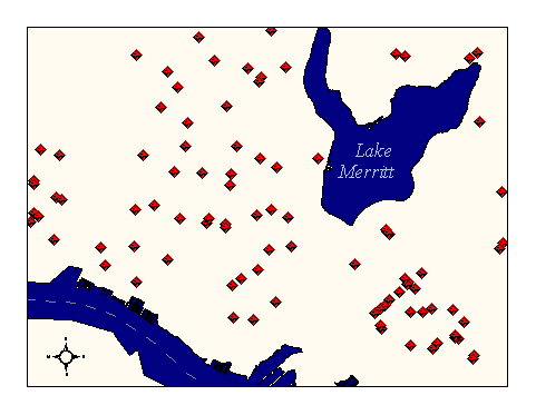
Data Set Description: This layer contains the locations of Hazardous Materials Facilities with business locations in the City of Oakland. Data for these facilities is captured by the inspectors of the Office of Emergency Services on an ongoing basis. Because of this active data maintenance program, this layer contains very detailed and current information about hazardous materials facilities. Non-standard Attributes in table:
Data Source History: Vibhor Jain, OES, captures data collected in the field by OES hazmat inspectors (LeRoy Griffin, Steve Craford, etc.) in a Microsoft Excel program. He then converts the Excel file to a DBF format, imports the DBF into ArcView 2.1 and geocodes each facility by address to the GIS streets layer. Quality Check: The match-rate for geocoding hazmat facilities has been approximately 80% (unexpectedly low) due to missing streets in the airport area and Port of Oakland area. This omission has recently been corrected (these areas lacked orthophoto coverage), and future updates to the hazmat layer will use this corrected streets version to establish the locations of hazmat facilities. Security restrictions: Clearance from Henry Renteria or Renee Domingo is required to access this layer outside Oakland. Call (510)238-3938. Update Frequency: Monthly or as per Vibhor Jain's schedule of updates. Update process:
As Vibhor Jain receives new hazmat data from the OES inspectors, he updates his Excel spreadsheet. Over intervals still to be determined, Vibhor posts these changes to a contact in OCIS for conversion into a GIS layer via the geocoding process. |