|
|
| |||||||||||||||||||||||||||||||||
|
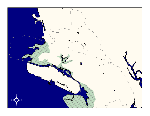
City of Oakland data set: Liquifaction Zones |
|
 |
Who maintains the data for this layer: Calif. dept.of conservation Data Maintainer Phone: Unavailable Who converted the data into a GIS format: Kyle Draganov GIS Technician Phone: unlisted Size of GIS layer (KB): 320 Size of export file (KB): 666 Where is the layer stored (on the k-drive): k:\gisdata\other\liquif.e00 This GIS layer was last updated on: 12/31/96 This metadata was last updated on: 3/20/97 This layer's FGDC category description is: Hydrography |
|
Data Set Description: This layer delineates areas of landfill which will liquify during large earthquakes. Non-standard Attributes in table:
Data Source History: The earthquake planning scenario map was based on a 1:100,000 USGS quad. The map was produced by the California Department of Conservation in 1987, and was part of a study to find the varying degrees of land movement during an earthquake, depending on soil type. Kyle Draganov, Earthwise Consulting, digitized the liquifaction zones from an earthquake planning scenario map produced by California Department of resources. Land in the liquifaction zones are known to be landfill and will liquify during an earthquake. Quality Check: No quality control activities to date. Security restrictions: No security restrictions on this layer Update Frequency: No scheduled updates Update process:
Update process is not yet defined |