|
|
| |||||||||||||||||||||||||||||||||
|
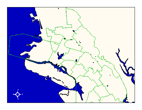
City of Oakland data set: School districts--junior-high schools |
|
 |
Who maintains the data for this layer: Gil Brennum, OUSD Data Maintainer Phone: (510) 836-8112 Who converted the data into a GIS format: Jonathan Lowe GIS Technician Phone: unlisted Size of GIS layer (KB): 52 Size of export file (KB): 73.5 Where is the layer stored (on the k-drive): k:\gisdata\gover\ousdjhs.e00 This GIS layer was last updated on: 2/26/97 This metadata was last updated on: 3/20/97 This layer's FGDC category description is: Governmental Units |
|
Data Set Description: This layer contains the junior high school district boundaries for junior high schools in the City of Oakland. Non-standard Attributes in table:
Data Source History: Gil Brennum of Oakland Unified School District delivered paper maps of the school district boundaries. Pat Combs of OCIS digitized these boundaries using the center of pavement layer as a base and the paper maps as a reference. Quality Check: Jonathan Lowe, Local Knowledge Consulting, quality checked the layer by closing gaps between boundary lines intended to connect but not snapped during arcview digitization work by OUSD. Jonathan then built the coverage for polygon topology. Security restrictions: No security restrictions. Update Frequency: No scheduled updates by OCIS. OUSD will update for 1997. Update process:
OUSD will notify OCIS GIS staff when updates to the school layers are required and will supply OCIS with shapefiles for conversion to ArcInfo coverages. |