|
|
| |||||||||||||||||||||||||||||||||
|
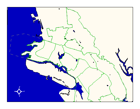
City of Oakland data set: Plan Areas |
|
 |
Who maintains the data for this layer: Frank Kliewer, OPB Data Maintainer Phone: (510) 238-4779 Who converted the data into a GIS format: Julia Howlett GIS Technician Phone: unlisted Size of GIS layer (KB): 212 Size of export file (KB): 172 Where is the layer stored (on the k-drive): k:\gisdata\cadas\planarea.e00 This GIS layer was last updated on: 10/25/96 This metadata was last updated on: 3/20/97 This layer's FGDC category description is: Governmental Units |
|
Data Set Description: This layer delineates the planning areas in the City of Oakland, as designated by the Office of Planning and Building. Planning areas are useful for dividing large datasets into more manageable sizes--for example, the parcels are subdivided along planning area boundaries. Non-standard Attributes in table:
Data Source History: CH2M Hill delivered this layer to OCIS without documentation. The file was in Arc/Info format and contained splined annotation of the planning area names. Quality Check: Julia Howlett corrected irregularities to the Planning area dataset during her work with parcel libraries. The planning area boundary separating the Fruitvale area from the San Antonio area divided parcels and had to be realigned along rear lot lines. Security restrictions: No security restrictions Update Frequency: No scheduled updates Update process:
Update process is not yet defined |