|
|
| |||||||||||||||||||||||||||||||||
|
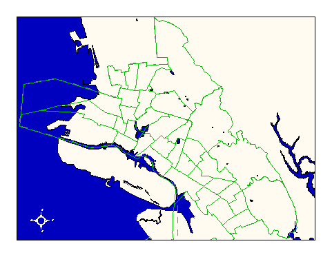
City of Oakland data set: Patrol beats of Oakland Police Department |
|
 |
Who maintains the data for this layer: Thomas Cave (OPD) Data Maintainer Phone: (510) 238-3277 Who converted the data into a GIS format: Julia Howlett GIS Technician Phone: unlisted Size of GIS layer (KB): 180 Size of export file (KB): 168 Where is the layer stored (on the k-drive): k:\gisdata\gover\polbeat.e00 This GIS layer was last updated on: 3/3/97 This metadata was last updated on: 3/20/97 This layer's FGDC category description is: Governmental Units |
|
Data Set Description: Patrol beats guide police dispatch and patrol activities. They define general areas of surveilance for each officer's daily activity. Non-standard Attributes in table:
Data Source History: Joanne Ward, OCIS, digitized the police beats based upon a paper map from Police Capt. Mike Simms. Joanne compared the paper map to an ArcInfo streets coverage and heads-up digitized the beat lines. Quality Check: John Burgess of OPD made linework and attribute changes to update the beats from 57 to 34. When the streets layer's accuracy improved, Julia Howlett transformed the updated polbeat shapefile into a coverage and made sure it matched the accuracy of the Streets coverage. Security restrictions: No security restrictions. Update Frequency: No updates scheduled Update process:
Thomas Cave (OPD) updates linework and attributes using Arcview 3.0. The updated shapefiles are then transformed into coverages by OCIS GIS staff and redistributed. |