|
|
| |||||||||||||||||||||||||||||||||
|
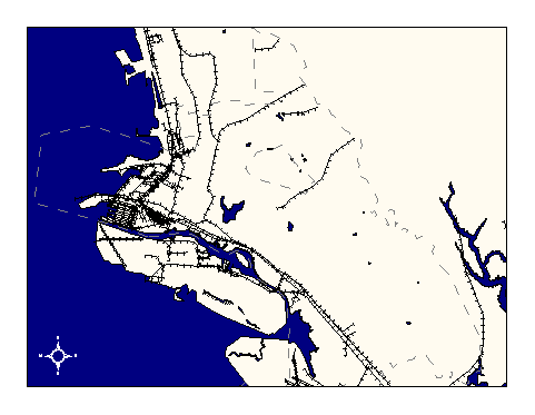
City of Oakland data set: Rail lines |
|
 |
Who maintains the data for this layer: Teale Data Center Data Maintainer Phone: Unavailable Who converted the data into a GIS format: Jonathan Lowe GIS Technician Phone: unlisted Size of GIS layer (KB): 240 Size of export file (KB): 386 Where is the layer stored (on the k-drive): k:\gisdata\trans\rail.e00 This GIS layer was last updated on: 1/23/96 This metadata was last updated on: 3/12/97 This layer's FGDC category description is: Transportation |
|
Data Set Description: The rail layer contains railroads and miscellaneous transportation features such as transmission lines, airports, pipelines, etc., and is based on the USGS DLG transportation linework derived from the DLG-3 1:100,000 scale digital data derived from the original major/minor pairs. DLG coding is documented in "Digital Line Graphs from 1:100,000 Scale Maps, Data Users Guide 2, 1985" available from the U.S. Department of the Interior, U.S. Geological Survey, Reston, Virginia. (Description by Teale Data Center Data Library Users Guide) Non-standard Attributes in table:
Data Source History: Teale Data Center was the source of the rail dataset. Teale's data quality assessment is as follows:"The data is derived from USGS 1:100,000 quad sheets. Features less than 10-15 years old may not appear. Feature completeness and accuracy is good for pipelines, rail lines, airports and tramways. Few of the other types listed are present in the layer. Attribute accuracy and completeness is good, although attributes only identify the feature as to type." Teale data contact: Roger Ewers, phone: (916) 263-1488. Jonathan Lowe (LKC) converted the dataset from Teale from an Albers projection, NAD27, units meters, to California State Plane, NAD83, units feet, using Arc/Info projection tools and two aml's called "alb2spc.aml" and "nad2783.aml." Quality Check: No quality control yet performed outside of OCIS. Security restrictions: No security restrictions. Update Frequency: No scheduled updates. Update process:
Update process is not yet defined |