|
Data Set Description:
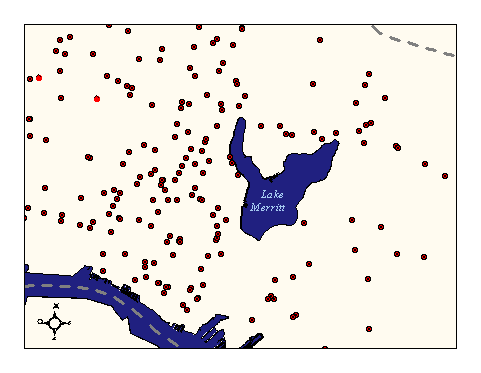
This layer captures the locations of underground storage tanks with the potential for leaks. The dataset is used to map potential groundwater contamination from leaking storage tanks.
Non-standard Attributes in table:
- U_ID: Provides the user with a unique indentfying number for each polygon in the layer.
- ENTERDATE = ENTER DATE: Date reviewed case was first entered on the computer. This date should never change.
- REVIEWDATE = REVIEW DATE: Date case was last reviewed --only change this date when you make a significant computer change such as a status change.
- CORRDATE = CORRESPONDENCE DATE: Date stamped on the most recent technical report. (Exclude quarterly monitoring reports.)
- REPORTDATE = REPORT DATE: This corresponds to the stamped date on the new material received on a site that was not previously on LUSTIS. This date does not change once it is entered.
- UPDATE = UPDATE: A one letter field which enables us to keep track of the new cases that are imputed. N = represents a new case entered into the LUSTIS database which will be included in the FUELS bi-monthly update C = represents major changes in sitename or address L = represents a site needing a new labelIn short, new cases that have been entered in the time between update lists will contain an N in the UPDATE field, and cases that have a sitename or address alteration will contain a C in the UPDATE field.
- REVSTAT = REVIEW STATUS: NC = not checked, i.e. new material in the file has not been checked yet C = checked, i.e. all material in the file has been reviewed M = an M in the third character spot indicates that the file is missing note: almost every case should be checked
- STAFF = STAFF: The initials of the last person to have evaluated the case.
- PILOTPROGM = PILOT PROGRAM: The letter (Y) indicates that Lustis (leaking Underground Storage Tank Information Survey) will be updated by quarterly reports from the Local Agency. All documents including technical reports can be routed directly to file. The letter (Y) is to be assigned by a Section Leader or Division Chief.
- RBFILENO = RB FILE NUMBER: This number is assigned to each fuel leak file only. The first number is the County Code separated by a dash and a unique number assigned in sequential order. Note: Check list of old file numbers to be reused prior to assigning a new number. This number is assigned to each fuel leak file only. The first number is the County Code separated by a dash and a unique number assigned in sequential order. Note: Check list of old file numbers to be reused prior to assigning a new number.
- CASENO = CASE NUMBER: The number assigned by a local agency (if any).
- SITENAME = SITE NAME: The name of the responsible party or of the site itself. The following are some general data input rules: - If unknown, write UNKNOWN- If private property, i.e. residence or undeveloped land, write the last name and then "PROPERTY", e.g.
- DOE PROPERTY.- If name contains initials, do not use periods nor spaces, e.g. UC BERKELEY.- Do not spell out "and", use "&".- Do not use periods, e.g. COMPANY = CO, CORPORATION = CORP, INCORPORATED = INC, etc.- If there is space, spell out name, e.g. PACIFIC BELL not PAC BELL.- If the site is a major oil producer, write just the company name (e.g. TEXACO not JOE'S TEXACO), unless you are sure the site is independently owned. - For names beginning with MAC or MC, no spaces after them, e.g. MACDONALD, MCKIVITT.
- STREETNO = STREET NUMBER: The address number of the site.
- STREET = STREET: The street on which the site is located. When imputing this information onto the database, don't use periods, and abbreviate whenever possible:AVENUE......AVE HIGHWAY....HWY ROAD.......RD BOULEVARD...BLVD LANE.......LN STREET.....ST COURT.......CT MOUNT......MT TERRACE....TERR DRIVE.......DR PARKWAY....PKWY *TRAIL.....TRL EXPRESSWAY..EXPWY PLACE......PL *WAY.......WY *(Abbreviate only when there's not enough space).For numerical streets, use the numbers only, do not spell out, e.g. 2ND ST, 4TH AVE, etc. For alphabetic streets, do not use quotation marks, e.g. E ST.
- ADDRESS = Streets number and Street in one field
- XSTREET = Cross Street
- CITY = CITY: The city in which the site is located. City names should be spelled out whenever possible, e.g. SOUTH SAN FRANCISCO.
- ZIP = ZIP: Zip code. If unknown leave blank.
- COUNTY = COUNTY: The following counties are in our jurisdiction and have the corresponding county codes: 01 Alameda 49 Sonoma 07 Contra Costa 28 Napa 38 San Francisco 48 Solano 41 San Mateo 43 Santa Clara 21 Marin
- PRIORITY = no description of this term found in original meatdata.
- LOCLAGENCY = LOCAL AGENCY: The following are special local agency codes:
- LOP: 01000 Alameda County (Berkeley, Oakland, Hayward, Dublin, San Lorenzo, Albany, Castro valley) 01099 Alameda County Water District (Fremont, Union City, Newark) LIA: 01006 Alameda County, City of Pleasanton 43099 Santa Clara Valley Water District 21028 Marin County, San Rafael 01007 Alameda county, city of San LeandroFor all others not listed, use the county number followed by three zeros. For example, the Contra Costa local agency is designated 07000.
- MOPNO = MOPNO: Major Oil Producer Number (if available). The following are common major oil producers and their corresponding initials:Arco-- A Exxon-- E Texaco-- T Beacon-- B Kayo-- K Thrifty-- THBritish Petroleum-- BP Mobil-- M Ultramar-- ? Chevron-- C Shell-- S Unocal--UThe following applies when imputing the MOPNO:Arco-- A, followed by the station number.Beacon-- B, followed by the street number. If there is no street number, use the street name.British Petroleum-- BP, followed by the station number.Chevron-- C, followed by the station number.Exxon-- E, followed by the station number.Kayo-- K, followed by the street number. If there isn't a street number use the street name. Be aware that Kayo is also Conoco and Jet gas stations. Use "K" for all of these.Mobil-- M, followed by the station number.Rotten Robbie-- No procedure as of this time.Shell-- S, followed by the station number minus the first three numbers 204, i.e. 204-5044 would be S5044.Texaco-- T, followed by the county number, and then the street number.Thrifty-- TH, followed by the station number.Southland (7 Eleven)-- No procedure at this time. *If a station is supposed to have a station number, and you can't find it use the first letter followed by the street number.
- SUBP & SUBS = PRIMARY & SECONDARY SUBSTANCE: The primary substance should be the substance with the highest potential volume of spill. The secondary substance should be the one with the second most highest potential volume of spill. The following are the most common substances and their chemcodes:Gasoline 8006619 Regular Gas 12032 Diesel 12034 Unleaded Gas 12031Waste Oil 12035 Misc. Motor Fuel 12036 Oil and Grease 41 Solvents 13Codes for other substances can be found on the attached sheet. Use Gasoline only if you are sure the substance is not diesel. Use Misc. Motor Fuel only if you are not sure and the substance could be diesel. If three or more substances are present and one is waste oil, this takes precedence. It should be listed regardless of volume, but only if tank leaked.
- MAXSOIL = MAX SOIL CONCENTRATION: The maximum soil concentration of contaminants in PPM discovered over the entire case history. - Use a -1 if soil tests and results are nondetectable
- MAXGW = MAX GROUNDWATER: The highest concentration of contaminants in PPB found in groundwater during the entire case history. Should the trend of the groundwater contamination drop to a lower level of concentration, the change should be noted in the COMMENT field.- Free product in the well should be designated 99999999 (Free product should be a measurable quantity)- Free product or sheen in the tank pit should be designated 88888888 (This code should be replaced once monitoring well results are available)- A sheen in the well should be designated 77777777- -1 indicates that all water analysis are non-detectableA contaminant concentration that is from the pit or a boring can be used in the MAXGW field if there are no monitoring wells on site. However, a note should be made in the COMMENT field stating where the sample is from, and the result should be replaced by one from a monitoring well as soon as the information is available. Remember, monitoring well results supersede all others.
- BENZENE = BENZENE: The most recent concentration of benzene in PPB found in groundwater. This result should be from a monitoring well. (Only if case handler requires this information.)
- MAXBENZENE = MAXBENZENE: The highest historical concentration of benzene in PPB found in groundwater. This field should never change once the data has been entered, unless new information shows a higher concentration than that previously recorded. Should the trend of the benzene contamination drop to a lower level, the change should be reflected in the BENZENE field and/or COMMENT field.
- 50', or 4 - monitoring wells have been installed and water analysis shows non-detect.
- NOWELLS = no description of this term was found in the original metadata
- XCORDINATE = See matchlevel description
- YCORDINATE = See matchlevel description
- LATITUDE = See matchlevel description
- LONGITUDE = See matchlevel description
- MATCHLEVEL = MATCHLEVEL DESCRIPTION & DATA INTEGRITY OF LATITUDE/LONGITUDE FIELDSThe program used (Mapinfo) to generated the latitude and longitude data does so in an imperfect way. Some of the latitude and longitude data are incorrect by a known margin of error. The Matchlevel field contains a code which indicates the size of error. Below is a description of each of the Matchlevel field codes. Please utilize the lat/long data with care and with the below matchlevel codes in mind.The purpose of this matchlevel field is to allow users of the data to know the reliability of the data. Please be aware of the these facts about data integrity before using the latitude and longitude data!The RWQCB Toxics GIS department is currently updating all matchlevel codes to ones and thus the data can be expected to improve with time. The following is a description of the codes in the matchlevel field: 1 Matchlevel 1 indicates that Mapinfo geocoded the site on the first run, or that it was manually geocoded by changing an incorrect address, street name, etc. It is safe to assume that Matchlevel 1 sites have been properly located. 2 Matchlevel 2 indicates that the site is between 1 and 4 blocks from where it is supposed to be.NOTE(A "Block" is defined here as a group of 100 address numbers. In many cities each block represents such a group (100 block, 200 block, etc). In practice, however, a grouping of 100 can represent more or less than one physical city block.) 3 Matchlevel 3: the site is between 4 and 7 blocks from where it should be. 4 Matchlevel 4: the site is between 7 and 10 blocks from its actual position. 5 Matchlevel 5 indicates that the site is greater than 10 blocks from where it should be or is not geocodable at this time. These sites do not show up on map layer. 0 This indicates that the site has not yet been geocoded. 99 Matchlevel 99: Site is not geocodable because address is missing or invalid. These addresses are currently being found and/or corrected so that they can be geocoded in the future by RWQCB staff. These sites also do not show up on map layer.
- GWDEPTH = GROUNDWATER DEPTH: The historical minimum depth to groundwater in feet from the ground surface. Report this value exactly as it is reported on the Site Report. (This should not be confused with ground water elevation, which corresponds to measurements made with respect to mean sea level).
- HOWDISCVER = HOW DISCOVERED: Describes how the leak was discovered. IC = inventory control SM = subsurface monitoring TT = tank test TC = tank closure NC = nuisance conditions OT = other means
- DISCVRDATE = DISCOVERY DATE: The date the leak was discovered. This date is on the Underground Storage Tank Unauthorized Release (LEAK) Contamination Site Report Form . (URF)
- HOWSTOPPED = HOW STOPPED: Decribes how the leak was stopped. RC = remove contents NT = new tank CT = close tank RT = repair tank RP = repair piping CP = change procedures OT = other means
- STOPDATE = STOP DATE: The date the leak was stopped. The date can be taken from the Unauthorized Release Form (URF).
- LEAKSOURCE = LEAK SOURCE: Decribes the source of the leak. T = tank P = piping U = unknown O = other source
- LEAKCAUSE = LEAK CAUSE: Decribes the cause of the leak. O = overfill C = corrosion F = structure failure S = spill L = loose fitting U = unknown T = other cause
- STATUS = STATUS: This field represents the phase of work currently being performed by the responsible party is. · 0 = No action has been taken by the responsible party after the initial verification of the leak and soil tests, other than a minor amount of soil excavation and disposal.· 1 = A leak is suspected at a site (i.e., poor inventory records, water in the tank, vadose monitoring system in alarm, etc.) but has not been confirmed. Includes inspection of the excavation, tank and appurtenant plumbing to determine existence of leak. It may also include taking samples from the excavation (or from borings for in-place closures) for analysis.· 3A = A workplan proposal and implementation schedule to determine the extent of groundwater contamination has been submitted. This plan includes the installation of monitoring wells.· 3B = This phase of work involves determining if groundwater has been impacted. Work performed during this phase includes the installation of up to three monitoring wells in order to determine the specific gradient. At least one well should be placed within 10' of the suspected point of discharge in a verified downgradient location. Other work performed during this phase may include soil borings, soil gas surveys, additional excavation and interim remediation measures. The case would move to status 5 when the work exceeds that which was required for gradient definition and initial groundwater verification (usually the installation of more than three wells).· 5C = This phase of work involves the definition of the boundaries of the contaminated plume. In order to be a 5C the responsible party must be taking steps to further define the lateral and vertical extent of contamination in the soil and groundwater. This phase is characterized by the installation of additional monitoring wells and/or borings, aquifer tests, soil gas surveys, continual groundwater gradient determinations and monitoring, and an assessment of all impacts on surface and groundwater.· 5R = A proposal and implementation schedule evaluating long term remediation has been submitted. The proposal should include a feasibility study, i.e. a remediation plan based on the consideration of a few options. · 7 = Implementation of the final corrective action plan, i.e. actual remediation begins. Usually requires regulatory agency approval.· 8 = Periodic groundwater or other monitoring at the site as necessary in order to verify and/or evaluate the effectiveness of remedial activities.· 9 = Case signed off by board.The following dates are assigned as the status progresses from one phase to another:
- DATE1 = DATE1 : Date status 1 was first assigned.
- DATE3A = DATE3A: Date status 3A was first assigned.
- DATE3B = DATE3B: Date status 3B was first assigned.
- DATE5C = DATE5C: Date status 5C was first assigned.
- DATE5R = DATE5R: Date status 5R was first assigned.
- DATE7 = DATE7 : Date status 7 was first assigned.
- DATE8 = DATE8 : Date status 8 was first assigned.
- DATE9 = DATE9 : Date status 9 was first assigned.
- INTERIM = INTERIM REMEDIATION:Y = Yes, interim remedial actions have been undertaken, e.g. soil venting, insitu biodegradation, or free product removal. Soil disposal or an effort to remove and dispose of all or most of the contaminated soil. Free product removal would be the installation of a free product removal system.N = No, no interim remedial actions have occurred.
- INTERMDATE = INTERIM DATE: Date interim remediation efforts were undertaken (If unknown default to report date then stamped date).
- ABATEMETHD = ABATEMENT METHOD: This field represents the status of remedial action. It should coordinate with the status field or interim remediation. NA = None required NT = No remedial action taken. ED = Excavate and dispose (landfill) of soil. ET = Excavate and treat soil. (e.g. aeration,biodegradation, etc.) FP = Free product removed. (e.g. skimmer used or vacuumed, pumped, etc.) GT = Pump and treat ground water. IT = Enhanced insitu biodegradation, soil or water. VS = Vent Soil insitu or vacuum extraction. CD = Cap siteYou can have up to 12 characters in this field so just keep adding new codes as remediation progresses. Do not use spaces or commas. Remember to remove the NT when there is an abate method.
- LEADAGENCY = LEADAGENCY: This is the agency that has oversight responsibility for the case.The default is to RI but a change to R or L requires a case handler confirmation. L = Local agency R = Regional board LI = Local agency is responsible for the case but the case is not being actively overseen. RI = Regional Board is responsible for the case but the case is not being actively overseen.
- CASELIST = CASE LIST: Indicates which printed list the tank leak is include on. FUEL = gasoline, diesel, waste oil, and fuel oil SBT = south bay division solvent tank (Santa Clara County) MSCA = south bay division superfund site (Santa Clara County) NBC = north bay counties solvent etc. tanks (all counties ex. Santa Clara) NCY = not an official case yet; no soil sample resultsFuel leak cases are filed in main file room and the NBC leak cases should be also filed in main file room, not in the public review room.
- ENFRCETYPE = ENFORCE TYPE: This field represents enforcement action taken by the lead agency. 0 = None taken*1 = A cleanup and abatement order or 13267 letter issued to an uncooperative responsible party*2 = A cleanup and abatement order or 13267 letter issued to a cooperative responsible party 3 = ACL or court injunction*13267 letters are identifiable by an official Regional Board letter signed by Steve Ritchie, and by the paragraph referencing article 13267.
- ENFRCEDATE = ENFORCE DATE: Date enforcement action was taken, i.e. date of Regional Board letterhead.
- RPSEARCH = RESPONSIBLE PARTY SEARCH: Financial status of responsible party. S = Solvent Identified and financially capable of performing work. I = Insolvent Identified and not financially capable of performing work. R = Recalcitrant resistant and rebellious. N = No responsible party identified. If none of the above are clear, then leave blank.COMMENT: Anything particular about the case that should be noted, e.g. note if URF only. Only 80 characters, so keep brief and abbreviate whenever possible.The following are some common abbreviations that you might come across and that can be used in the comment field:
- QMRP - Quarterly Monitoring Report Program(LOP Sites)
- SL - Soil
- TK - Tank
- URF - Underground Release Form
- WKPN - Work plan
- ATR - Aquifer Test Report
- IP - Investigation plan
- MW - Monitoring well
- REM - Remediation
- QTR - Quarter
- CONTAM - Contamination
- ND - Nondetect
- NFAP - No further action proposed
- NOV - Notice of violation
- CC - Case closure
- FP - Free Product
- AMT - Amount
- SBMTTD - Submitted
- FD - Fire Department
- TPH - Total petroleum hydrocarbons
- TPHD - Total petroleum hydrocarbons as diesel
- TPHG - Total petroleum hydrocarbons as gasoline
- TPHO - Total petroleum hydrocarbons as oil
- TVH - Total volatile hydrocarbons
- GW - Ground water
- MR - Monitoring report
- RPT - Report
- SCHD - Solano County Health Department
- ACHD - Alameda County Health Department
- ACWD - Alameda County Water District
- SCVWD - Santa Clara Valley Water District
- VC - Vinyl Chloride
- MC - Methyl Chloride
- *DCE - Dichloroethene
- *DCA - Dichloroethane
- *PCE - Tetrachloroethene
- *PCA - Tetrachloroethane
- TCA - Trichloroethane
- TCE - Trichloroethene
- SVOC - Semi Volatile Organic Compound
- VOC - Volatile Organic Compound
- THM - Tri Halomethanes
- *Add the number (e.g. 1,1,2,...) in front of the abbreviation.
- The following table lists PPB and PPM conversions:
- PPM mg/kg, mg/l PPB ug/l, ml/l, ug/kg
- The difference between PPM and PPB is 3 decimal places, e.g. 5.0 PPM = 5000.0 PPB.
- FUNDING = no description of this term was found in the original data
- COMMENT2 = no description of this term was found in the original data
- COMMENT3 = no description of this term was found in the original data
- COMMENT4 = no description of this term was found in the original data
- Chemical Codes
- CHEMCODE NAME ________________________________________________________________
- 8052424 Asphalt
- 71432 Benzene
- 09 Boiler Fuel
- 8007452 Coal Tar
- 77 Coolant
- 7440508 Copper
- 8002059 Crude Oil (Hazardous)
- 122 Cutting Oil
- 57125 Cyanides, Salts
- 12034 Diesel
- 610399 Dinitrotoluenes
- 52 Dry Cleaning Solvent
- 64175 Ethyl Alcohol (Ethanol)
- 107062 Ethylene Dichlor (same as Dichloroethene)
- 171 Freon
- 8006619 Gasoline
- 12 Heater Fuel
- 67630 Isopropyl Alcohol
- 8008206 Kerosene
- 84 Lacquer Thinner
- 7439921 Lead
- 71 Lubricating Oil
- 78933 Methyl Ethyl Ketones (MEK)
- 67561 Methyl Alcohol
- 75092 Mthylne Chloride
- 41 Mineral Spirits
- 12036 Miscellaneous Motor Fuel
- 08 Motor Oil
- 101 Naptha Distillate
- 7440020 Nickel
- 1313991 Nickel Oxide
- 41 Oil and Grease
- 51 Oil & Grease Waste
- 49 Paint Thinner
- 1336363 PCB'S (Polychlorinated Biphenyls)
- 25037665 Polyester Resin
- 12033 Premium Gasoline
- 95636 Pseudocumene
- 12032 Regular Gasoline
- 13 Solvents
- 8052413 Stoddard Solvent
- 79016 TCE (Trichloroethene or Tri Chloroethylene)
- 109999 Tetrahydrofuran
- 108883 Toluene
- 80 Transmission Fluid
- 12031 Unleaded Gasoline
- 12035 Waste Oil
- 32 Waste Water
- 61 Water & Oil Mix
- 106423 Xylene
- Lustis Field Structure:
- FIELD NAME FIELD TYPE # OF STATE FIELD DEFAULT CHARACTERS (Y/N) VALUE_________________________________________________________________
- RBFILENO CHARACTER 7 N
- CASE NO Numeric 10 N
- PILOTPRGM Character 1 Y
- ENTERDATE Date 8 Y NBlank REVIEWDATE Date 8 Y
- CORRDATE Date 8 N NBlank REPORTDATE Date 8 Y
- NBlank
- UPDATE Character 1 Y
- REVSTAT Character 3 N NBlank
- HOWDISCVER Character 2 N
- DISCVRDATE Date 8 N
- HOWSTOPPED Character 2 N
- STOPDATE Date 8 N
- LEAKSOURCE Character 1 N
- LEAKCAUSE Character 1 N
- STAFF Character 3 N
- SITENAME Character 30 Y NBlank
- STREETNO Character 11 Y
- STREET Character 20 Y NBlank
- CITY Character 20 Y NBlank
- ZIP Character 9 Y
- COUNTY Character 2 Y NBlank
- LOCLAGENCY Character 5 N NBlank
- MOPNO Character 8 N
- PRIM SUB Character 8 Y
- MAXSOIL Numeric 6 N 0
- MAXGW Numeric 8 N 0
- MAXBENZENE Numeric 8 N 0
- BENZENE Numeric 8 N 0
- CASETYPE Character 1 Y U
- GWDEPTH Character 4 N
- STATUS Character 2 Y 0
- DATE1 Date 8 Y
- DATE3A Date 8 Y
- DATE3B Date 8 Y
- DATE5C Date 8 Y
- DATE5R Date 8 Y
- DATE7 Date 8 Y
- DATE8 Date 8 Y
- DATE9 Date 8 Y
- INTERIM Character 1 Y N
- INTERMDATE Date 8 Y
- ABATEMETHD Character 14 Y NT
- LEADAGENCY Character 2 Y RI
- CASE LIST Character 3 N NBlank
- ENFRCETYPE Character 1 Y 0
- ENFRCEDATE Date 8 N
- RESEARCH Character 1 Y
- COMMENT Character 80 Y
- Abbreviation Key:
- NBlank = Do not leave this field blank. You must choose from among the listed alternatives to fill the field. If there is nothing under the Default Value column corresponding to a particular field, this implies that it is o.k. to leave the field blank until it can be filled.
- The following are some common abbreviations that you might come across and that can be used in the comment field:
- QMRP - Quarterly Monitoring Report Program(LOP Sites)
- SL - Soil
- TK - Tank
- URF - Underground Release Form
- WKPN - Work plan
- ATR - Aquifer Test Report
- IP - Investigation plan
- MW - Monitoring well
- REM - Remediation
- QTR - Quarter
- CONTAM - Contamination
- ND - Nondetect
- NFAP - No further action proposed
- NOV - Notice of violation
- CC - Case closure
- FP - Free Product
- AMT - Amount
- SBMTTD - Submitted
- FD - Fire Department
- TPH - Total petroleum hydrocarbons
- TPHD - Total petroleum hydrocarbons as diesel
- TPHG - Total petroleum hydrocarbons as gasoline
- TPHO - Total petroleum hydrocarbons as oil
- TVH - Total volatile hydrocarbons
- GW - Ground water
- MR - Monitoring report
- RPT - Report
- SCHD - Solano County Health Department
- ACHD - Alameda County Health Department
- ACWD - Alameda County Water District
- SCVWD - Santa Clara Valley Water District
- VC - Vinyl Chloride
- MC - Methyl Chloride
- *DCE - Dichloroethene
- *DCA - Dichloroethane
- *PCE - Tetrachloroethene
- *PCA - Tetrachloroethane
- TCA - Trichloroethane
- TCE - Trichloroethene
- SVOC - Semi Volatile Organic Compound
- VOC - Volatile Organic Compound THM - Tri Halomethanes
- *Add the number (e.g. 1,1,2,...) in front of the abbreviation.
- Chemical Codes
- CHEMCODE NAME _________________________________________________________________8052424 Asphalt
- 71432 Benzene
- 09 Boiler Fuel
- 8007452 Coal Tar
- 77 Coolant
- 7440508 Copper
- 8002059 Crude Oil (Hazardous)
- 122 Cutting Oil
- 57125 Cyanides, Salts
- 12034 Diesel
- 610399 Dinitrotoluenes
- 52 Dry Cleaning Solvent
- 64175 Ethyl Alcohol (Ethanol)
- 107062 Ethylene Dichlor (same as Dichloroethene)
- 171 Freon
- 8006619 Gasoline
- 12 Heater Fuel
- 67630 Isopropyl Alcohol
- 8008206 Kerosene
- 84 Lacquer Thinner
- 7439921 Lead
- 71 Lubricating Oil
- 78933 Methyl Ethyl Ketones (MEK)
- 67561 Methyl Alcohol
- 75092 Mthylne Chloride
- 41 Mineral Spirits
- 12036 Miscellaneous Motor Fuel
- 08 Motor Oil
- 101 Naptha Distillate
- 7440020 Nickel
- 1313991 Nickel Oxide
- 41 Oil and Grease
- 51 Oil & Grease Waste
- 49 Paint Thinner
- 1336363 PCB'S (Polychlorinated Biphenyls)
- 25037665 Polyester Resin
- 12033 Premium Gasoline
- 95636 Pseudocumene
- 12032 Regular Gasoline
- 13 Solvents
- 8052413 Stoddard Solvent
- 79016 TCE (Trichloroethene or Tri Chloroethylene)
- 109999 Tetrahydrofuran
- 108883 Toluene
- 80 Transmission Fluid
- 12031 Unleaded Gasoline
- 12035 Waste Oil
- 32 Waste Water
- 61 Water & Oil Mix
- 106423 Xylene
- MATCHLEVEL DESCRIPTION & DATA INTEGRITY OF LATITUDE/LONGITUDE FIELDS
- The program used (Mapinfo) to generated the latitude and longitude data does so in an imperfect way. Some of the latitudeand longitude data are incorrect by a known margin of error. The Matchlevel field contains a code which indicates the size of error. Below is a description of each of the Matchlevel field codes. Please utilize the lat/long data with care and with the below matchlevel codes in mind.
- The purpose of this matchlevel field is to allow users of the data to know the reliability of the data. Please be aware of the these facts about data integrity before using the latitude and longitude data! The RWQCB Toxics GIS department is currently updating all matchlevel codes to ones and thus the data can be expected to improve with time.
- The following is a description of the codes in the matchlevel field:
- Matchlevel Definition
- 1 Matchlevel 1 indicates that Mapinfo geocoded the site on the first run, or that it was manually geocoded by changing an incorrect address, street name, etc. It is safe to assume that Matchlevel 1 sites have been properly located.
- 2 Matchlevel 2 indicates that the site is between 1 and 4 blocks from where it is supposed to be.
- NOTE (A "Block" is defined here as a group of 100 address numbers. In many cities each block represents such a group (100 block, 200 block, etc). In practice, however, a grouping of 100 can represent more or less than one physical city block.)
- 3 Matchlevel 3: the site is between 4 and 7 blocks from where it should be.
- 4 Matchlevel 4: the site is between 7 and 10 blocks from its actual position.
- 5 Matchlevel 5 indicates that the site is greater than 10 blocks from where it should be or is not geocodable at this time. These sites do not show up on map layer.
- 0 This indicates that the site has not yet been geocoded.
- 99 Matchlevel 99: Site is not geocodable because address is missing or invalid. These addresses are currently being found and/or corrected so that they can be geocoded in the future by RWQCB staff. These sites also do not show up on map layer.
Data Source History:
The dataset was supplied by Andy Peri of the San Francisco Bay Region's Regional Water Quality Control Board (RWQCB) and geocoded by Julia Howlett of JRH Consulting.
Quality Check:
This layer was created by geocoding site addresses against the Streets layer to produce points. The geocoding process locates the street for each entry and then interpolates the building number from an address range between street intersections. Because this process is imperfect, points showing site locations are approximate. Nine sites from the original dataset were unable to be geocoded and are not included in htis layer.
Security restrictions:
No security restrictions at this time
Update Frequency:
No updates scheduled
Update process:
Update process is not yet defined
|