|
|
| |||||||||||||||||||||||||||||||||
|
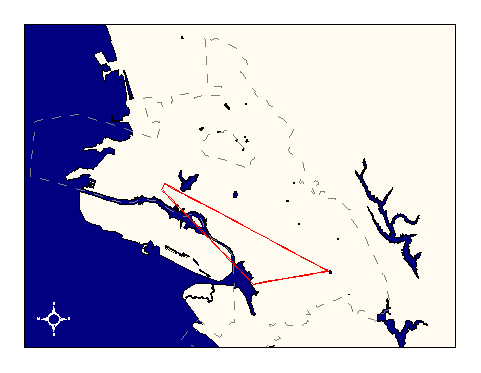
City of Oakland data set: Transmission pathways between aerials |
|
 |
Who maintains the data for this layer: Gregg Obuch Data Maintainer Phone: (510) 238-6900 Who converted the data into a GIS format: Jonathan Lowe GIS Technician Phone: unlisted Size of GIS layer (KB): 96 Size of export file (KB): 5 Where is the layer stored (on the k-drive): k:\gisdata\other\transmit.e00 This GIS layer was last updated on: 10/30/96 This metadata was last updated on: 3/12/97 This layer's FGDC category description is: Other (Non-FGDC) |
|
Data Set Description: Microwave signal path between radio sites. Non-standard Attributes in table:
Data Source History: Based upon Gregg Obuch's (OCIS, Telecommunications Director) description of signal transmissions, Jonathan Lowe connected the point locations of the aerials (see Aerial Locations GIS layer) with lines signifying the transmission paths for signals passed between the aerials. Quality Check: No quality control measures were performed on this layer. Security restrictions: No security restrictions Update Frequency: No scheduled updates. Update process:
No update process yet established. |