 |
This article originally appeared in Geospatial Solutions Magazine's Net Results column of January 1, 2002. Other Net Results articles about the role of emerging technologies in the exchange of spatial information are also online. |
| 1. Introduction and Glossary 2. Spawn of the TIGER 3. Species Specialization 4. Surveying the Territory | |
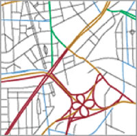
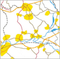
| Surveying the Territory Aside from some hype splatter now and then, the spatial community is benefiting from the renewed efforts of the spatial data vendors to corner these emerging LBS and real-time navigation markets. The challenge is keeping up with the various details of each offering. That said, here are a few tips to keep in mind when evaluating the data of any big spatial data vendor. Coverage.In the old days, accuracy and attributes were the name of the game; they're still important, but also check for such details as coverage outside the United States, consistency of the data schema, data format options, and navigational attribute detail - inclusion of information about relative road height, speed, time-of-day restrictions, and similar rules. In some cases, what used to be a special option has now become standard. Less common to typical spatial applications, but perhaps the most interesting options, are the addition of real-time travel data feeds, voice-enabled datasets, and driver assistance options. A dataset's coverage is its geographic extent. At its inception, for example, GBF/DIME had irregular coverage of the United States, with more detail at selected urban centers. In areas of recent data-conversion efforts, such as less wealthy European countries such as Portugal, or in rapidly developing countries like Brazil or Singapore, a dataset may have the same structure as its U.S. equivalent, but may contain empty values where the data do not yet exist. Coverage density also varies. Navtech's European data, for example, include what they call "detailed city coverage" versus "inter-town coverage" (see Figure 2 and 3). Detailed city coverage supports door-to-door directions to a specific address, whereas inter-town coverage connects main road networks for cross-country routing. Check your area specifically before buying.
In addition to the complete U.S. coverage offered by all three vendors, there are variations in international coverage from vendor to vendor. Among their own or their partners' international datasets, GDT lists Canada, Argentina, and Brazil. Navtech lists Western Europe, Kuwait, South Africa, and the United Arab Emirates. And Tele Atlas lists Western Europe, Australia, and Singapore. Also, the United States is not always the most detailed dataset. For instance, the Tele Atlas data format is the same in Europe and the United States, with all the same shapefiles and attribute columns for each. Only in Europe, however, does the model capture the relationship between public squares and their entry points. Americans don't have nearly as many pigeon-filled piazzas as the Italians, but if we ever do, the fields are there, waiting to be populated. This consistency of data schema makes it easier to write applications for multiple countries, but requires care by the data administrator in understanding which datasets are valid in each country. In my own experiences with international spatial datasets, this structural consistency has proved to be a blessing. Storage. Another emerging trend is the migration from file systems to databases for storage of spatial datasets. The ability to store a formerly tiled collection of files as a single seamless table in a database makes this shift attractive to managers of large geographies. Format. Format also can influence the purchasing decision - different vendors supply different output formats, some ready for immediate insertion to a particular database. For instance, Navtech supplies an Oracle ( www.oracle.com ) 8i format and Tele Atlas offers an automated shapefile loading script for IBM Informix (www.ibm.com) databases. Before being dazzled by the navigational attributes of any vendor, be sure that your application software is able to ingest and process that particular dataset's format. The more complex the model of turn restrictions, overpasses, and time-based route behavior, the more sophisticated (and costly) the software needed to make sense of that data. Vendors like Navtech and Tele Atlas recognize this, of course, and provide their own or third-party tools designed specifically to perform routing calculations on their formats. In real-time. After the routine checks are done, don't forget to ring the bells and blow the whistles. Spatio-temporal data processing is on the rise (see "Net Results," November 2001) and Tele Atlas aims to lead the charge. Their strategy, with a product called the Real-Time Traffic Report supplies dynamic content for the Web or wireless applications by joining text descriptions - those same reports you hear on the radio each morning - with their actual locations on the map. By predefining junctions or areas where accidents are most likely to recur and associating them with an ID value, Tele Atlas can very quickly augment the text feeds from various traffic-watching organizations with the proper locational attribute, including an estimate of how long the event will continue. Tele Atlas plans to expand the service to include real-time weather and traffic speed data as well. Speak to me, Scotty. User-friendly voice guidance is well-established on Star Trek, but Navtech may bring it to 21st-century Earth. By recording hundreds of commands in English, German, French, Italian, Dutch, Spanish, and Japanese, and equipping their dataset with elements they call "phonemes," Navtech's data will support navigation systems that listen for verbal commands from a driver and return verbal replies from the system. Navtech hopes that by 2005, a pure voice communication system will eliminate all physical contact between human and machine. Just talk (but don't mistakenly say the word "reverse" while zooming down the freeway!). Telematics. Navtech is also busy prototyping a driver assistance system. Its Web site describes the system as enabling: Intelligent headlights, which automatically aim to provide optimal illumination around curves. Adaptive cruise control, which maintains a safe interval from slower vehicles ahead while maintaining the functions and utility of traditional cruise control. Smart throttles, which anticipate road conditions (curves and grades) to save fuel and reduce emissions. Front, side, and rear collision and obstacle warning and avoidance systems. Warning systems to alert drivers (or eventually even automatically slow vehicles) when a curve is being approached too fast, when the car appears to be drifting out of its lane or drifting off the road. Again, the effort is collaborative, involving programs such as the Intelligent Vehicle Initiative (IVI) in the United States; the IN-ARTE in Europe; Nextmap, AGORA, PROBE-IT and research projects with automotive companies. Telematics and navigational warning systems are not limited to automobiles. At the ESRI EMEA Conference in Portugal in October 2001, a Saudi Arabian delegate informed me of his plans to track the course of oil tankers in an effort to detect and prevent shipwrecks. Some European countries are developing uniform policies to integrate telematics applications for monitoring water and air pollution, for medical informatics and health care, and for distance learning into government, business, and education. The work at hand. Maybe 2002 will be a brave new year after all. Even the fear that naturally arises from terrorism and economic decline cannot preempt the deep satisfaction of a job well done. I don't know if I'd want my car's headlights to develop a life of their own, especially for $399 a year, but a spatial solution that reduces emissions is hard to ignore. So keep an eye out for spatio-temporal data service partnerships and increasingly sophisticated spatial data offerings in the year ahead. Whether your spatial projects require reference, inventory, or modeling components, I hope a thorough understanding of today's commercial datasets helps you select the right basemap data and forge ahead with your meaningful work. |
| 1. Introduction and Glossary 2. Spawn of the TIGER 3. Species Specialization 4. Surveying the Territory |
|
|